A vibrant network of connected open spaces between the Merrimack Valley and Mystic River watershed into Boston.

FOLLOW US:

tri community greenway stoneham
/* NORTH ANDOVER */ NORTHANDOVER /* ANDOVER */ ANDOVER /* TEWKSBURY */ TEWKSBURY /* WILMINGTON */ WILMINGTON /* NORTH READING */ NORTH READING /* READING */ READING /* BURLILNGTON */ BURLINGTON /* WAKEFIELD */ WAKEFIELD /* WOBURN */ WOBURN /* STONEHAM */ STONEHAM /* WINCHESTER */ WINCHESTER /* ARLINGTON */ ARLINGTON /* MEDFORD */ MEDFORD /* SOMERVILLE */ SOMERVILLE /* RIVERS */ MERRIMACK RIVER MYSTIC RIVER /* DOTTED LINES */ /* BOXFORD */ BOXFORD FORESTWINDRUSH FARM /* HORN POND */ HORNPOND /* MILL POND */ MILLPOND /* FELLS */ MIDDLESEXFELLSWEST & EAST /* SWAN POND */ SWANPOND /* QUANNAPOWITT */ LAKE QUANNAPOWITT /* MARY CUMMINGS */ MARY CUMMINGSPARK & WHISPERINGHILL WOODS /* LANDLOCKED */ LANDLOCKEDFOREST /* SAWMILL */ SAWMILL BROOK /* BARE MEADOW */ BAREMEADOW /* MAILLET */ MAILLETTHELIN /* READING FOREST */ READINGTOWN FOREST /* CHANDLER */ CHANDLERWELL FIELDS /* ROGERS */ ROGERSPARK /* TEWKSBURY */ TEWKSBURYSTATEHOSPITALPARKS /* WILM FOREST */ WILMINGTON TOWNFOREST /* GOLDSMITH */ GOLDSMITHFOSTER’SWILKINSON /* HAROLD P */ HAROLD PARKERSTATEFOREST /* WARD HILL */ WARDHILL /* POMPS */ POMPSPOND /* INDIAN BAKER */ INDIANBAKER’SDOYLE /* FISH HAMMOND*/ FISH BROOKHAMMONDBALD HILL /* RETELLE */ RETELLERESERVATION /* JAMES WOODCHUCK */ JAMES SWAMPWOODCHUCK HILL /* TOWN BRUIN */ TOWN FARMBRUIN HILLFARNSWORTHFOSTER FARM /* OSGOOD*/ OSGOODWEIR HILL /* CARTER MAZURENKO */ CARTER HILLMAZURENNKO FARM /* LUBBERS*/ LUBBERSBROOK /* CANAL*/ DOG PARK &MIDDLESEX CANAL /* MENOTOMY*/ MENOTOMYROCKS /* MYSTIC*/ MYSTICLAKES /* SOMERVILLE RAIL TRAIL*/ RAIL TRAIL /* IPSWICH RIVER PARK */ IPSWICHRIVER PARK /* LAKES */ /* DOTTED LINES */ /* LABELS */ NEARBY OPEN SPACES BAYCIRCUITTRAIL THE MYSTICLINK TRAIL

Stoneham

The MLT does not go through any green spaces in Stoneham. It does offer a nice route along the Bear Hill Golf Club. Most importantly, the MLT terminates in a small parking lot near the Stoneham end of the 6.63-mile Tri-Community Greenway. The TCG is a great bike/walking route connecting Stoneham, Winchester and Woburn, with a spur that ends at Horn Pond in Woburn.

The 2,575-acre Middlesex Fells Reservation is accessible from Stoneham, including Sheepfold Dog Park.

Here is a link to the Massachusetts State GIS Map from which this map was derived: MASS GIS MAP

Below is a Google map of Stoneham that you can also explore.

Featured in Stoneham

More Resources in Stoneham

Tri Community Greenway

Somerville Walking Routes

Friends of the Tri-Community Greenway - Stoneham, Woburn, Winchester

stoneham

Stoneham Dept of Open Space and Recration

The Stoneham Department of Open Space and Recreation
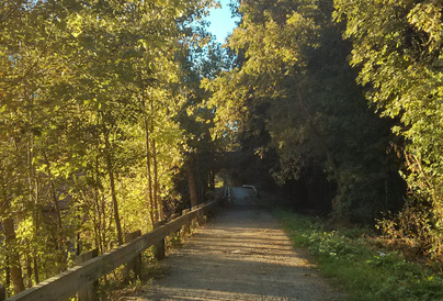
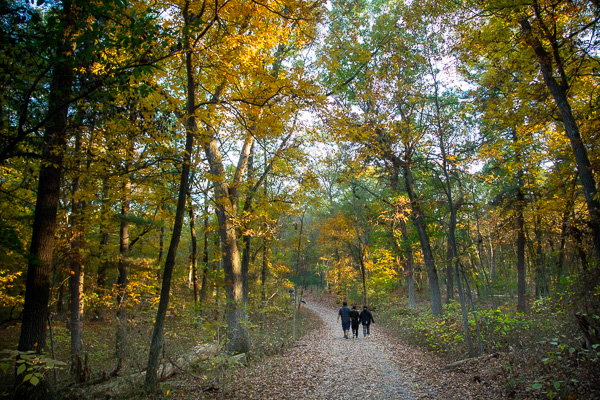
Seal_of_Massachusetts

The Middlesex Fells

At Middlesex Fells, you can hike, bike, fish, or let your dog run free in the off-leash area. Rent a canoe or kayak to explore Spot Pond.

The Spot Pond Loop

10 Mile loop around spot pond.