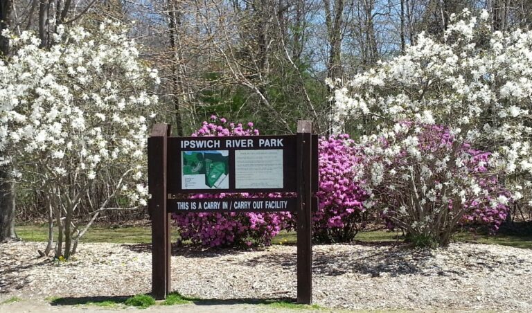
A vibrant network of open spaces between the Merrimack Valley and Mystic River watershed into Boston.

FOLLOW US:

/* NORTH ANDOVER */ NORTHANDOVER /* ANDOVER */ ANDOVER /* TEWKSBURY */ TEWKSBURY /* WILMINGTON */ WILMINGTON /* NORTH READING */ NORTH READING /* READING */ READING /* BURLILNGTON */ BURLINGTON /* WAKEFIELD */ WAKEFIELD /* WOBURN */ WOBURN /* STONEHAM */ STONEHAM /* WINCHESTER */ WINCHESTER /* ARLINGTON */ ARLINGTON /* MEDFORD */ MEDFORD /* SOMERVILLE */ SOMERVILLE /* RIVERS */ MERRIMACK RIVER MYSTIC RIVER /* DOTTED LINES */ /* BOXFORD */ BOXFORD FORESTWINDRUSH FARM /* HORN POND */ HORNPOND /* MILL POND */ MILLPOND /* FELLS */ MIDDLESEXFELLSWEST & EAST /* SWAN POND */ SWANPOND /* QUANNAPOWITT */ LAKE QUANNAPOWITT /* MARY CUMMINGS */ MARY CUMMINGSPARK & WHISPERINGHILL WOODS /* LANDLOCKED */ LANDLOCKEDFOREST /* SAWMILL */ SAWMILL BROOK /* BARE MEADOW */ BAREMEADOW /* MAILLET */ MAILLETTHELIN /* READING FOREST */ READINGTOWN FOREST /* CHANDLER */ CHANDLERWELL FIELDS /* ROGERS */ ROGERSPARK /* TEWKSBURY */ TEWKSBURYSTATEHOSPITALPARKS /* WILM FOREST */ WILMINGTON TOWNFOREST /* GOLDSMITH */ GOLDSMITHFOSTER’SWILKINSON /* HAROLD P */ HAROLD PARKERSTATEFOREST /* WARD HILL */ WARDHILL /* POMPS */ POMPSPOND /* INDIAN BAKER */ INDIANBAKER’SDOYLE /* FISH HAMMOND*/ FISH BROOKHAMMONDBALD HILL /* RETELLE */ RETELLERESERVATION /* JAMES WOODCHUCK */ JAMES SWAMPWOODCHUCK HILL /* TOWN BRUIN */ TOWN FARMBRUIN HILLFARNSWORTHFOSTER FARM /* OSGOOD*/ OSGOODWEIR HILL /* CARTER MAZURENKO */ CARTER HILLMAZURENNKO FARM /* LUBBERS*/ LUBBERSBROOK /* CANAL*/ DOG PARK &MIDDLESEX CANAL /* MENOTOMY*/ MENOTOMYROCKS /* MYSTIC*/ MYSTICLAKES /* SOMERVILLE RAIL TRAIL*/ RAIL TRAIL /* IPSWICH RIVER PARK */ IPSWICHRIVER PARK /* LAKES */ /* DOTTED LINES */ /* LABELS */ NEARBY OPEN SPACES BAYCIRCUITTRAIL THE MYSTICLINK TRAIL

North Reading

The MLT connects to the 3500-acre Harold Parker State Forest, including the Lorraine campground with 89 campsites. The route runs on sidewalks and some nicely wooded paths in North Reading and into Bare Meadow in Reading. Limited parking on Marblehead Street near trailhead into Harold Parker.

The 49-acre Ipswich River Park is accessible on foot from Haverhill Street. Another nice 19-acre wooded area is Eisenhaure Woods, accessible off Haverhill Street via Eisenhaure Lane to Tower Hill Rd to Burham Drive.

Below is a Google map of North Reading that you can also explore.

Featured in North Reading

Swan Pond

One of the large beaver-created lakes that is too far from houses to create trouble for humans.Beaver here are free

Read More »

More Resources for North Reading

North Reading

North Reading Recreation

The protection of open space in North Andover ensures the preservation of the town’s heritage, scenic landscapes, and critical natural resources.
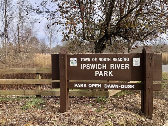
Ipswich River Park

Ipswich River Park is a 49 acre site at the junction of Haverhill, Central and Chestnut Streets.

North Reading Rail Trails

North Reading Rail Trail

Feasibility Study funded by 2018 Town Meeting and 2020 MassTrails grant complete (PDF).